Mostly Harmless

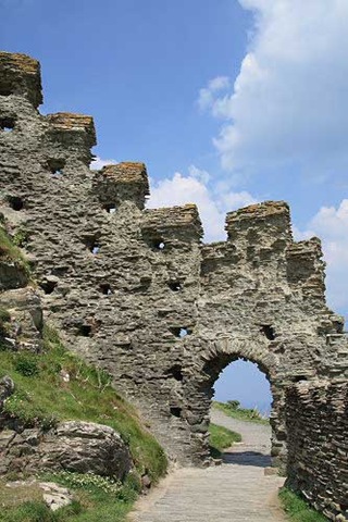
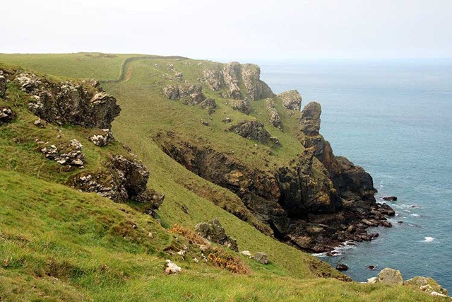
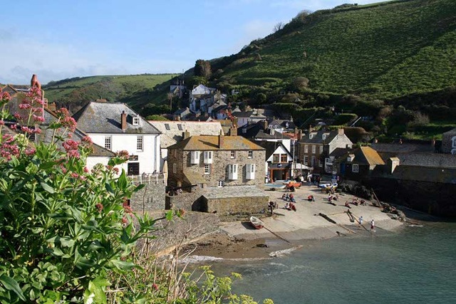
Time to leave Rock and it wasn’t a bad morning for it – uninspiring in a dull, grey sort of way. It was dry though so a good day for travel. Travel, in this case, was to be to Taunton in Somerset to call in on friends, Barry and Irene, recently having moved down from Chesterfield. We had met Barry and Irene in France a few years ago while we were delayed on our journey by our then recalcitrant Vectra Anglaise. They had suggested a commercial campsite which was a mere 10 minutes walk from their house on the edge of Taunton, so we had booked in for two nights.

The 110 miles or so was blissfully uneventful and the directions to the site from the M5 junction were unusually excellent. We duly arrived at about midday having found the site very easily and checked in. This was very much not our normal kind of site, being all hard standing and somewhat regimented in layout, but it was adequate, convenient to our purpose and the sanitary facilities were very good.

Billy in a completely unnatural habitat 
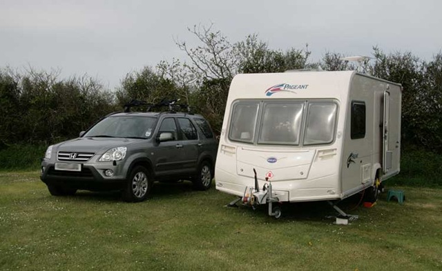
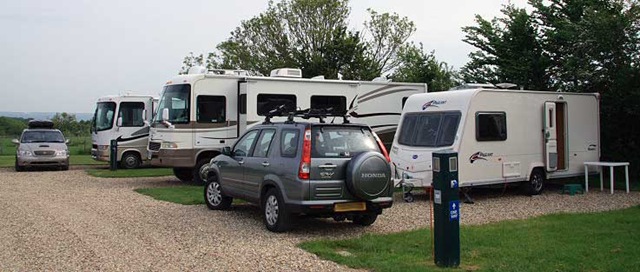
There were what appeared to be a number of long term residents but that impression may have been caused by the most immediately noticeable feature: several obscenely large American-style motor homes with wind-out side extensions – the works. Poor Billy was told to go and site himself between two such monsters and was immediately dwarfed. Siting between several huge American cousins was a little like invading someone else’s established space but the big guys turned out to be mostly harmless, if not actively friendly, and he settled down, The stones of the hard-standing hurt his feet a little but all was well for a short stay.

The campsite was apparently started to support a business (Van Bitz). People stay here to have horribly expensive tracking systems and other accessories fitted to their horribly expensive, horribly large motor homes. Maybe we should just be fitting wheels to houses.

The afternoon was reunion time with Barry and Irene. This involved seeing their house, being introduced to downtown Taunton, drinking their wine (we had very ungraciously finished all ours before leaving Rock and not had time for a shop visit to restock), and being generally well fed.

Well fed and watered, it was time to stagger back and ensure that Billy had not received any improper advances.

Steppin’ Out

Our last day near Rock bought us another beautifully sunny morning but things were supposed to collapse a tad at some time in the afternoon. So, we decided to take the ferry across the Camel Estuary to Padstow and walk north the three miles or so to Stepper Point.

Low tide across the Camel estuary There was, of course, a brisk breeze blowing and the most interesting sight, for us, was some spectacular kite surfing going on back and forth across the Camel estuary. (Any record that may have been captured of this is on real film – sorry.) We’ve seen a little kite surfing before but not at the level of expertise we saw today. Surfing is one thing, flying a kite is another. Speaking as a total clutz, just how anybody has enough coordination to stay balanced on a surf board whilst remaining in control of a large kite such that they can steer it and go where they intend is completely beyond me. I watched a guy scream towards the shore and, as he approached, cause the kite to lift him out of the water whereupon, in mid air, he deftly kicked the board off his feet before he himself landed gently on the sand barefoot. Quite spectacular.

Stonechat Neither of us felt particularly sprightly for whatever reason today; weary leg syndrome on both our parts, I think. The wildlife did its best to lift our spirits, though. As well as seeing our first swifts of summer, there were lots of stonechats stonechatting away along the shoreline. (Stonechats are so named because their call sounds like two stones clacking together.) They are quite common along the Cornish coast. However, today, one allowed Carol to get close enough with a camera to grab a picture or three. Normally, birds seem to wait patiently as you extract said piece of apparatus, watch bemusedly as you struggle to unbolt one lens in favour of bolting on a longer one, then, just as you raise the laboriously prepared camera to your eye, flap nonchalantly away just before the shutter clicks.

The tide was very low and, to get enough water, the ferry was operating a long way out of Padstow at the time of our return trip. It felt as though we were being dumped not far short of Daymer Bay which made our return walk to the car a little longer than anticipated but we seemed to manage to stir our weary limbs into action one last time.

They got the weather exactly right, it’s raining now (5:00 PM).

On to Taunton to drop in on some friends tomorrow.

Still Crazy after all these Years

Sun and heat – wonderful. Even the wind wasn’t blowing very forcefully. We decided to go and look at the coast around Tintagel, about 12 miles north of us. The old legs were grumbling a little so, once there, we chose to make it a lazy, short saunter and just enjoy the beautiful weather.

Tintagel Head The Island at Tintagel Head looked a very imposing formation as we approached from the south (another National Trust car park, bless them). Closer inspection revealed large amounts of people wandering about its relatively flat top. Unknown to me, this is supposedly the legendary birthplace of King Arthur and is now run by English Heritage. “£4.70 each to get in, please, and would you like a guide book, too?” “Not for another £3.99, I don’t, thanks.” Quelle cheapskate!

As we had driven through Tintagel itself on our approach we had seen a couple of bus loads of enfants Francaises. These formed a considerable number of those now crawling all over the top of King Arthur’s island. “They come here because King Arthur is on the French curriculum”, we were told. “He’s no longer on the English national curriculum, though.” Wonderful stuff.

Fortifications on the island The steps down from the mainland and up the approach to the fortified island are seriously steep and not for the weak of limb. When the only armoury available was bows and arrows, this must have been one incredibly strong stronghold. As we tried to make our way up the steps into the stronghold, out swarmed quarante six (46) enfants Francaises. Since the steps are narrow as well as steep, this constituted something of a bouchon (blockage). We were stuck half way up (sounds like the Grand Old Duke of York, again). Fortunately, being enfants Francaises, they were polite and obedient and were encouraged by their teacher to stop their swarming to allow us to complete our climb.

Odd goings on at King Arthur's pad While we were taking in the views from and of the island itself another large group gathered. One lady was handling something I first thought to be a dowsing stick but which, on closer inspection, turned out to be some sort of long flexible spring-like device. Curious, I thought. We continued our wander and eventually looked back. The spring-like device may have been some kind of indicator as to when conditions were right because eventually this latest group of, well, loonies, distributed themselves around the western extreme of the island, and stared west with their arms held low out from their sides as if receiving mystical signals. The spring lady, whom I now took to be the High Priestess Loony, was arching her back in apparent raptures of some kind. Every now and then one of the group would drop to the ground, either sated or entranced – who knows? Someone suggested they were waiting for their spaceship. We’ll have some of what they’re drinking.

What an intriguing place.

The Mighty Quin

(Yes, I know Manfred Mann’s Mighty Quinn has two "n"s. Read on …)

At last, a dry day accompanied by relatively uninterrupted sun. Yesterday having been dry, too, the coastal path should have dried out and not be too treacherous in any of its more extreme sections. We’d been waiting for just these conditions to do the section from Port Quin to Port Isaac and back. We had done about two thirds of this route on a previous visit but had stopped early, whether from collapsing morale or collapsing weather, I cannot remember.

Port Quin itself isn’t exactly mighty. It has a National Trust car park at the bottom of a 1 in 4 (25%) gradient, a handful of cottages (half a dozen or so) and, well, nothing else; no cafe, no pub, nothing. For this reason it is best to start at the Port Quin end of the walk so that refreshment may be had at the other end in Port Isaac before making the return.

A Thrift Encrusted Height between Ports Quin and Isaac What is mighty, is the coastal path between Ports Quin and Isaac. It may be only three miles long in passing Kellan Head, Varley Head and Lobber Point, but this is a punishing, roller-coaster of three miles with around seven long, steep, lung-bursting ascents and, of course, approximately the same number of long, steep, knee-crucifying descents. The rewards for indulging in all this masochism are views of some of the most spectacular coastline on offer and, of course, a sense of achievement. Today, the air and light were magnificent. We were even rewarded by having a bird’s eye view of more seals foraging close to the cliffs beneath us.

 A punishing staircase of 144 steps followed by 30 more cut through the gorse leaving Pine Haven This time all went well and we arrived in Port Isaac for a refreshing cider (carefully avoiding the pants pub, of course) and to refill our water bottle before inflicting yet further lung and knee pain on the return three miles. The seals were still there. Given the severity of the path, I was surprised just how many people were there, too. It’s a very popular route.

Waiting at our goal back in the car park in Port Quin was another reward in the shape of two sausage sarnies (sandwiches, to foreign speakers). There were even some picnic tables to make our late lunch comfortable. Given the long, steep climbs into and out of Port Quin, I was amused also to notice a bicycle stand in the car park. (Bravo, anyone who has used it.) We were happily munching away, glowing both in the sun and in our aforementioned sense of personal achievement when, calmly sauntering into the car park came a couple we had spotted earlier in Port Isaac. The man had a prosthetic right leg!

Our sense of achievement may have suffered a little but not our spirits. What a great day!

Misty Mountain Hop

A morning with a little local mist rising from the fields around Billy greeted us. This soon burned off, though, and we were at last starting in T-shirts with the promise of a dry, calm, largely sunny day. Some mist could “hang around on some of the coastal fringes” but things were looking promising so we decided to retrace our steps across the local golf course, to Polzeath. From Polzeath, there was a headland to the north which we had either not seen before or, for part of it, seen only in some horrible weather conditions (slanting rain) on a previous Carol’s-camera-wrecking trip.

Wheatear on Pentire ThingyA slightly misty background to Pentire Head As we made our way across the golf course dodging the occasional golf ball (FORE!), we could see … yes, the bit of coast we were heading for was, indeed, one of the “coastal fringes” around which the mist “could hang”. No matter, the day was splendid so we carried on undaunted and started the climb up to Pentire Point/Head. Pentire Thingy seems to be suffering from a slight identity crisis; it’s Pentire Head on the National Trust signs and Pentire Point on the Ordnance Survey map. Whatever it is, together with Rumps Point, it makes a spectacular piece of coast. The wheatears we passed on the way up seemed to be enjoying it, too, and didn’t care what it was called. The thin veil of mist didn’t spoil our views or enjoyment but it did turn the cameras into something resembling excess baggage. We made it around the coast and then cut back across the headland to return once again via Polzeath.

Inland was still sunny and the prospect of being able to cook outside (at last) was making us salivate. So, after dodging yet more golf balls (FORE!) on our return trip, we detoured an extra mile to call in to the local Spar for something to sling on George (our you-know-whose electric grill), sausages and pork steaks, together with the makings of a Greek salad.

After a round trip of between nine and ten miles, the first beer went down exceptionally well and it was wonderful to take of our walking boots and pad around barefoot in the grass. The second beer was pretty good, too.

We did cook outside but, once again, life clouded over and cooled down so we ate inside again. A wonderful day.

Here Comes the Sun

A dull, grey and rainy start to the day was apparently going to be “clear from the west”. Sure enough, it did. I set about boning a chicken for the evening’s planned Thai green curry while Carol set off on her bike to get a required grocery or two from the local Spar. With its usual impeccable sense of timing, more dull, grey rain immediately arrived from the west and Carol was wet and we were back where we’d started. We did have the groceries and a boned chicken, though.

The spell of weather wasn’t too much of a hardship since we were expecting visitors, our friends Jan and Jon, for the latter part of the afternoon and evening. Jan was first taking part in a 60+ mile bicycle ride around the St. Agnes area (rather you than me) before they came on to a previously arranged meeting point. So, ‘t was out with the books and puzzles to wait for a message announcing their arrival.

Puzzle, puzzle, read, read, pitter, patter.

3:00 PM. An odd brightening, a strange blueness, bursts of a strange yellow brilliance, an even stranger lack of wind. Could this be the aforementioned “clearing from the west”? Out with the chairs for the first time this trip.

4:00 PM. SMS message: bike ride over, leaving St. Agnes in 10 mins.

5:00 PM. SMS message: we’re here.

The picturesque Port Isaac 'Port Wenn' school Though a Cornwall resident, Jan had never seen Port Isaac, a particularly picturesque fishing port on the north Cornwall coast about eight miles from our camp site. Port Isaac is appealing enough to have been chosen as the location of the TV series Doc Martin for which it acquired the stage name of Port Wenn. Having “cleared from the west”, the evening was very pleasant and off we set for a swift visit before dinner.

Port Isaac is a prime tourist magnet, especially having become a TV star. Quite why the pub right on the harbour (called “The Mote”) is so poor, I just cannot imagine. Possibly, they don’t need to put in any effort simply because of the place’s popularity. “Half a dry cider, please.” “We don’t have any cider by the half – all large bottles.” And mostly Magners, I noticed. Cornish cider is great, why would a Cornish pub be selling Irish cider? I know: it’s trendy (and, in my opinion, almost taste-free). Nearly everything here is bottled. There are a mere two pumps: Doom Bar (which is, at least, Cornish) and Red Stripe Lager. “OK, two of us will split a pint of Magners”. There’s a decent looking barista machine to the side – “and a coffee, please”. “Certainly” – unfortunately, the barista machine goes unused because, unnoticed by me, there is also pot of filtered-and-kept-warm-for-Lord-knows-how-long coffee lurking on a partially hidden hotplate.

There is a good pub in Port Isaac. It’s called “The Slipway Hotel” and is very close to the harbour, on the corner immediately opposite the fishmonger’s shop. It has a canopy-covered seating area outside and a decent selection of beverages and food inside. Guess where you should go if you happen to visit Port Isaac?

Fanfare for the Common Man

The morning started with the most welcome news of Gordon Brown’s bloody nose stemming from the previous day’s London mayoral elections following close on the heels of Labour’s set of recent local election defeats. Not content with single-handedly decimating peoples’ pension funds as Chancellor of the Exchequer, having been handed the post of Prime Minister on a silver platter rather than earning it, this most vindictive of politicians presides over the adding of yet further fuel tax, watches prices spiral uncontrollably, then, while everyone is smarting anyway, sticks the boot in by eliminating the 10p tax band thus cold-heartedly penalising the lowest income members of society. Let’s kick us while we’re down, eh, Gordon? Rub salt into our wounds, why don’t you? This contemptible man richly deserves to be politically crucified. (Maybe he’s an SNP mole sent into England deliberately to ruin the economy and destabilize the nation? Damn fine job.)

Buoyed up by the common man’s common sense, we started our day with another bicycle pilgrimage to Rock’s fish shop (brill, this time) followed by some housekeeping chores: coughing up for the camp site, washing, and an essential trip into Wadebridge to visit Tesco for food and alcohol stocks (the latter of which appear to evaporate alarmingly). Arghh – hardly any special offers! This must be a rare full-price week at Tesco. There was, of course, the ubiquitous Hardy’s Crest which is always said to be half price, £3.99 instead of £7.99, in absolutely every store. I have never seen it sold anywhere at £7.99. (Good job too, at £7.99 it would be a complete rip-off.)

We had another reason for our trip into Wadebridge: the Ship Inn was reported (on the Internet – Carol checked at the previous McDonalds) as having wi-fi. I was going to be quite happy to sup a pint while posting blog entries. Found a suitable parking space and … boarded up with a “business for sale” sign adorning the front wall. Drat! Back to Billy with our booty.

The day having warmed up nicely after lunch, we took a cross country wander from St. Minver Lowlands to Polzeath. I was thinking that, Polzeath being a surfing beach, there might just be some wi-fi presence for all the surf bums to hook into. So I packed the laptop in a rucksack and off we went. Having covered the 2.5 miles to Polzeath, an enquiry of the young man selling us two ice creams sounded hopeful; apparently Carter’s Pub and Restaurant up the (very steep) hill out of Polzeath was wi-fi enabled. Up and up we went and sure enough, lo and behold a “free wi-fi inside” sign. A couple of espressos won us the password from the bartender and we were in. “Oh, that’s why I can’t connect”, quoth another chap sitting in the bar with a beer and a laptop .

Across the dunes and the Camel estuary to Padstow beyond Two further espressos later, we returned on a rambling 4 mile route via Trebetherick, Daymer Bay, the coastal path through some very sandy dunes, and Rock (far too many Sloane Rangers this Bank Holiday weekend) to St. Minver Lowlands and Billy with his waiting brill.

A great day – the wine’s evaporating well again. 🙂

Billy Rolls to Rock

I think it’s fair to say that we know of no site with a better view than the Caravan Club site at St. Agnes Beacon. I think it is also fair to say that we know of no windier site than the Caravan Club site at St. Agnes Beacon. Today was the start of our third week and time to roll on to Rock. We were sad to be leaving the view but, perhaps, not so sad to be moving on to somewhere a little more sheltered, having been relatively frequently battered by the winds for the last week.

The morning was fair with broken cloud and, there being no rush, we had a final wander up to the top of St. Agnes Beacon to take in the 360 degree panorama before going over to say our farewells to Wheal Coates. On the right day, this stretch of coastline is breathtaking; we’d never tire of it. However, ‘t was time to tear ourselves away and pack up to head up to Rock; well, St. Minver Lowlands, to be precise.

Billy Rocks We’ve had almost every direction wind that it’s possible to have over the past two weeks. Today it was relatively light and in the southerly quarter again which helped us slightly on our mere 35 mile trip to Rock. We got Billy settled into his new home with ease, aided by our traditional "installation" beer or two, then had a spot of grilled asparagus with Parma ham and shaved pecorino cheese for lunch before finally using the bicycles to zip off into Rock to investigate the fish supply.

Enter the indispensable WD40; our bikes had been frequently saturated and completely unused over the past two weeks so that the chains were almost rusted to the cogs. (Memo to self: don’t bother with bikes in Cornwall again.) Fortunately, the WD40 worked its magic and freed things up sufficiently for us to arrive at Rock’s wonderful wet fish shop at about 4:00 PM just as the lady was cleaning up and trying to close early. Mercifully, she took pity on us and retrieved and filleted a couple of bright-eyed and glistening Gurnard which are destined to join a stinging nettle butter sauce, probably with a hint of garlic. Whatever I did for this gastronomic delight the first time (last year) was very successful, even if it did cause the fish shop lady’s eyebrows to fly up (subtext: stinging nettles – are you mad?). If I can somehow drag it out of the memory banks and make it work again, Gastroblog will need updating.

It’s windy again.

The May Song

Attending May Day in Padstow is becoming something of a habit. We started last year, just because we were in the area. This year, we made the effort to plan our excursion. The excitement is all about welcoming summer on May 1st. Last year the weather was astonishing. This year, the weather hadn’t quite got the message but it was, at least, sunny and dry, which went against the general flow this week.

Floral Smile Blue Oss procession Having decorated all the streets with colourful flags, the Padstonians’ celebrations centre around processions following two "’obby ‘osses": the blue ‘oss, which is the young pretender and hits the streets at 10:00 AM, and the red ‘oss which is the old original ‘oss and emerges at 11:00 AM. (There are actually also two childrens’ ‘osses which come out far too early in the morning.) In a display of considerable stamina and encouraged by its "teaser", each ‘oss continuously whirls and dances its way around a tortuous circuit of the streets of Padstow. Each ‘osses procession consists of throngs of supporters dressed all in white trimmed with ribbons of the appropriate colour, blue or red, together with a band of musicians continuously playing The May Song. Spring flower decorations abound and are worn on clothing, especially hats, as well as adorning the musicians’ instruments. If you’re especially lucky, you’ll hear encouraging chants of "’oss, ‘oss, wee ‘oss" above strains of the incessant music.

There is reportedly strong rivalry between the red and blue supporters but everything appears to be very good natured with mixed groups of supporters, those not in the actual processions, chatting on the streets – fraternizing with the enemy, as it were. A very few folks actually appear to be completely impartial wearing mixed ribbons of red and blue. Good for them.

The blue ribbon Oss passing the harbourWe arrived just in time to see the blue ‘oss procession passing the harbour area. Later, we also managed to see it emerging from an alley on our way out of town. We completely failed to get a good view of the red ‘oss for the second year running so, as complete outsiders, I think we are verging towards supporting the seemingly more accessible blue ‘oss. We also like that chap with the wonderfully floral hat (above right).

May Pole Other centres of attraction on May Day include a very colourful May Pole and, of course, drinking. (Lord knows when the pubs actually open – sun up, I think.) One must, of course, have a pasty for lunch but it must be carefully protected against raids by marauding seagulls which lie in wait for the unsuspecting tourist. This can only be washed down with a pint of something local, such as Tribute. The atmosphere is wonderful and completely addictive. Odd, given the amount of accordions. 🙂

Being unable to drink continuously and also being in need of a shopping trip and a McDonalds wi-fi for three days worth of blogging, we left Padstow to its ongoing celebrations soon after midday before finding our way back to St. Agnes via a roadside McDonalds, Lemon Quay in Truro and Sainsburys.

Bizarre planners that we are, having driven from St. Agnes to Padstow and back, tomorrow we move Billy on to Rock opposite Padstow across the Camel estuary. (Rock and its surrounds appear to be something of a McDonalds desert so Lord knows where we will find a wi-fi network to post this.)

The Wind Cries Mary

We woke early to Billy doing his by now relatively familiar St. Agnes dance: shake, rattle and roll. The promised band of dark grey cloud had arrived and was, indeed, above us together with the also promised accompanying persistent rain which was being lashed into poor ol’ Billy by what felt like a gale force northwesterly wind. Raising the blinds and peering out revealed no familiar view of the sea to the west; the dark cloud was solid all the way to the horizon (wherever that was). It looked as though we might go stir-crazy for a second day.

The rain on the van was so loud that we couldn’t hear BBC Radio Cornwall for the weather forecast and had to up the volume. It seemed life was supposed to be clearing from the west, though we could as yet see no evidence of it. The skies did eventually brighten and the rain desist by about 10:00 AM, though, leaving just the howling gale.

Turbulent sea, some of which seemed to be making it over the cliffs Encouraged by our neighbours, who seemed to be setting out on a return walk in excess of 20 miles (God help their dog) and not wishing to be complete wimps, we decided to try the coastal path north of St. Agnes towards Perranporth, I was a bit concerned about our leaving Billy and effectively removing 300lbs of ballast, but off we set. After a couple of steep descents and climbs to get to the section of path in which we were actually interested, we were doing well until we started getting wet and dived for cover in what I think was an old air-raid shelter on an airfield. The sky looked relatively clear but we were certainly getting wet. It seemed to stop so we resumed only to get wet again and dive back in. Two other guys joined us and began putting on their waterproof over-trousers. Eventually we wised up: our "rain" was, in fact, sea spray being blown up and over a 200ft cliff.

At a few points we were having difficulty just pushing our walking poles forward into the force of the oncoming wind. Ultimately, we came to a particularly exposed point about three miles out and were having difficulty just walking forward into the wind – this was more like storm force than gale force – so we decided that enough battering was enough and began to make our way back. Pausing for a pint of refreshment in St. Agnes, it was quite a relief to get "home" into the shelter of Billy, even though he was still doing his shake, rattle and roll.

A broom is drearily sweeping
Up the broken pieces of yesterday’s life,
Somewhere a queen is weeping,
Somewhere a king has no wife,
And the wind cries, "Mary".

(With apologies to the late, lamented, J. Hendrix, especially if I’ve misquoted.)

Wind was definitely today’s theme; "bloody Mary" might have been more appropriate. Pass the vodka!

Top
Follow

Get every new post delivered to your Inbox

Join other followers: